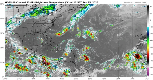
The Atlantic hurricane season has produced no hurricanes so far this year—an unusually calm stretch that stands out even in a basin known for dramatic year-to-year swings, and one that forecasters say cannot be explained by El Niño alone. According to reports, another atmospheric pattern may be suppressing storm formation and pushing the season’s typical peak later than usual.
Historically, an Atlantic season with zero hurricanes is almost unheard of. In the last 175 years of record-keeping, only two years—1907 and 1914—are documented as having no hurricanes in the Atlantic Ocean, the report noted. Even that comparison comes with a caveat: before the satellite era, storms that stayed out to sea or missed shipping routes could have gone undetected, meaning the official record may undercount some earlier hurricanes.
A “hurricane” is a tropical cyclone with sustained winds of at least 74 mph, and the Atlantic basin includes the Atlantic Ocean, Caribbean Sea, and Gulf of Mexico. The season runs from June 1 through Nov. 30, and activity typically ramps up through August before reaching a climatological peak around early to mid-September.
One factor often tied to lower Atlantic activity is El Niño, the periodic warming of the central and eastern tropical Pacific that can reshape global weather patterns. El Niño tends to increase upper-level winds over the Atlantic, creating vertical wind shear that disrupts the organization storms need to intensify into hurricanes. In many El Niño years, more tropical disturbances struggle to consolidate, and those that do form can have a harder time strengthening.
But the report emphasized El Niño is not the only player. Meteorologists also track other storm inhibitors that can dominate for weeks at a time, including intrusions of dry, stable air and dust from the Sahara known as the Saharan Air Layer. When that hot, dry air spreads across the Atlantic’s main development region, it can choke off thunderstorm growth, limit moisture, and make the atmosphere less favorable for tropical cyclones—particularly early in the heart of the season.
Short-term shifts in the Madden–Julian Oscillation (MJO), a pulse of enhanced and suppressed tropical rainfall that circles the globe every few weeks, can also tilt the odds. When the MJO phase favors sinking air over the Atlantic, storm formation can slow even if ocean temperatures are warm enough to support development.
A quiet start, however, does not guarantee a quiet finish. Some years deliver most of their hurricanes in a compressed late-season burst, especially when the atmosphere becomes more humid and wind shear relaxes. The Atlantic has also produced high-impact storms well after the traditional peak, including notable late-season hurricanes that formed in October and November.
Why this matters
Hurricanes remain among the costliest and deadliest U.S. weather disasters, and even one landfalling storm can define a season for communities along the Gulf Coast and East Coast. A lull can also create a false sense of security, since the most intense part of the season often arrives quickly and leaves limited time for preparation. Understanding why storms are being suppressed helps forecasters and emergency managers assess whether the calm is likely to persist—or break suddenly.
With weeks still left in the season’s most active window, forecasters will be watching for signs that the atmospheric brakes ease and allow systems to strengthen into hurricanes.